Skip to content · ⁨ข้ามไปยังเนื้อหา⁩

Cities and Urban Land-Use Patterns and Processes · ⁨รูปแบบและกระบวนการของเมืองและการใช้ที่ดินในเมือง⁩

AP Human Geography · ⁨AP ภูมิศาสตร์มนุษย์⁩ · Topic 6 · ⁨หัวข้อ 6⁩

Video lesson for this topic · ⁨บทเรียนวิดีโอสำหรับหัวข้อนี้⁩ Open the video page · ⁨เปิดหน้าวิดีโอ⁩
8:14

รูปแบบและกระบวนการของเมืองและการใช้ที่ดินในเมือง

ปัจจุบันมากกว่าครึ่งหนึ่งของประชากรบนโลกอาศัยอยู่ในเมือง และสัดส่วนนี้ยังเพิ่มขึ้นเรื่อยๆ เมืองสามารถดึงดูดเงินทุน การงาน และความคิดจากทั่วโลกมาไว้ได้ และในระดับ...

English narration · English + 中文 subtitles burned in · ⁨การบรรยายภาษาอังกฤษ · คำบรรยายภาษาอังกฤษ + 中文 ลอยตัวบนภาพ⁩

6.1 6.2

Origin and Growth of Cities · ⁨กำเนิดและการเติบโตของเมือง⁩

Syllabus · ⁨หลักสูตร⁩
English

Enduring Understanding (PSO-6): The presence and growth of cities vary across geographical locations because of physical geography and resources.

Learning Objective PSO-6.A: Explain the processes that initiate and drive urbanization and suburbanization.

  • PSO-6.A.1 Site and situation influence the origin, function, and growth of cities.
  • PSO-6.A.2 Changes in transportation and communication, population growth, migration, economic development, and government policies influence urbanization.
ไทย

ความเข้าใจที่ยั่งยืน (PSO-6): การมีอยู่และการเติบโตของเมืองมีความแตกต่างกันในแต่ละตำแหน่งทางภูมิศาสตร์เนื่องจากภูมิประเทศและทรัพยากรธรรมชาติ

จุดประสงค์การเรียนรู้ PSO-6.A: อธิบายกระบวนการที่เริ่มและขับเคลื่อนการเป็นเมืองและการขยายตัวของชานเมือง

  • PSO-6.A.1 ตำแหน่งที่ตั้งและสภาพแวดล้อมมีอิทธิพลต่อต้นกำเนิด หน้าที่ และการเติบโตของเมือง
  • PSO-6.A.2 การเปลี่ยนแปลงด้านการขนส่งและการสื่อสาร, การเติบโตของประชากร, การอพยพ, การพัฒนาทางเศรษฐกิจ และนโยบายของรัฐบาลมีอิทธิพลต่อการเป็นเมือง
English

Enduring Understanding (PSO-6): The presence and growth of cities vary across geographical locations because of physical geography and resources.

Learning Objective PSO-6.A: Explain the processes that initiate and drive urbanization and suburbanization.

  • PSO-6.A.3 Megacities and metacities are distinct spatial outcomes of urbanization increasingly located in countries of the periphery and semiperiphery.
  • PSO-6.A.4 Processes of suburbanization, sprawl, and decentralization have created new land-use forms—including edge cities, exurbs, and boomburbs—and new challenges.
ไทย

ความเข้าใจที่ยั่งยืน (PSO-6): การมีอยู่และการเติบโตของเมืองมีความแตกต่างกันในแต่ละตำแหน่งทางภูมิศาสตร์เนื่องจากภูมิประเทศและทรัพยากรธรรมชาติ

จุดประสงค์การเรียนรู้ PSO-6.A: อธิบายกระบวนการที่เริ่มและขับเคลื่อนการเป็นเมืองและการขยายตัวของชานเมือง

  • PSO-6.A.3 เมืองเมกะและเมโทรซิตี้เป็นผลลัพธ์เชิงพื้นที่ที่แตกต่างกันจากการurbanization ที่ตั้งอยู่ในประเทศชายแดนและกึ่งชายแดนมากขึ้น
  • PSO-6.A.4 กระบวนการ suburbanization, การขยายตัว และการกระจายอำนาจ ได้สร้างรูปแบบการใช้ที่ดินใหม่—including edge cities, exurbs, และ boomburbs—and new challenges.

Source: College Board AP Course and Exam Description · ⁨แหล่งที่มา: คำอธิบายหลักสูตรและข้อสอบ College Board AP⁩

English

Urbanization 城市化 is the growth in the share of people living in cities. It began with the agricultural surplus that freed some people from farming, and accelerated with the Industrial Revolution.

  • Urbanization rate rises fastest in developing countries today, driven by rural-to-urban migration.
  • A suburb 郊区 is a residential area on the edge of a city; suburbanization 郊区化 and sprawl 城市蔓延 spread cities outward.
  • Site 地点 (the physical features of a place) and situation 区位 (its location relative to other places) explain why a city grew where it did.
ไทย

Urbanization คือการเพิ่มขึ้นของสัดส่วนประชากรที่อาศัยอยู่ในเมือง เริ่มต้นจากการ surplus ของการเกษตรที่ทำให้คนบางส่วนออกจากการทำฟาร์ม และเร่งความเร็วด้วย Industrial Revolution

  • อัตราการ Urbanization เพิ่มขึ้นเร็วที่สุดในประเทศกำลังพัฒนาในปัจจุบัน ขับเคลื่อนด้วยการย้ายถิ่นจากชนบทสู่เมือง
  • Suburb เป็นพื้นที่พักอาศัยบนขอบเมือง; Suburbanization และ Sprawl ทำให้เมืองขยายออกไป
  • Site (ลักษณะทางกายภาพของสถานที่) และ Situation (ตำแหน่งสัมพัทธ์เทียบกับสถานที่อื่น) อธิบายเหตุผลที่เมืองเจริญเติบโตในที่นั้น
Vocabulary · ⁨คำศัพท์⁩ Train · ⁨ฝึกฝน⁩
English ไทย
Urbanization/ˌɜːbənaɪˈzeɪʃn/ การเป็นเมือง
suburb/ˈsʌbɜːb/ ชานเมือง
suburbanization/səˌbɜːbənaɪˈzeɪʃn/ suburbanization
sprawl/sprɔːl/ การขยายตัวของเมืองแบบไร้ทิศทาง
Site/saɪt/ ตำแหน่งที่ตั้ง
situation/ˌsɪtʃuːˈeɪʃn/ situation
6.3

Cities and Globalization · ⁨เมืองและการเป็นสากล⁩

Syllabus · ⁨หลักสูตร⁩
English

Enduring Understanding (PSO-6): The presence and growth of cities vary across geographical locations because of physical geography and resources.

Learning Objective PSO-6.B: Explain how cities embody processes of globalization.

  • PSO-6.B.1 World cities function at the top of the world’s urban hierarchy and drive globalization.
  • PSO-6.B.2 Cities are connected globally by networks and linkages and mediate global processes.
ไทย

ความเข้าใจที่ยั่งยืน (PSO-6): การมีอยู่และการเติบโตของเมืองมีความแตกต่างกันในแต่ละตำแหน่งทางภูมิศาสตร์เนื่องจากภูมิประเทศและทรัพยากรธรรมชาติ

จุดประสงค์การเรียนรู้ PSO-6.B: อธิบายว่าเมืองสะท้อนกระบวนการโลกาภิวัตน์อย่างไร

  • PSO-6.B.1 เมืองระดับโลกทำหน้าที่ในระดับสูงสุดของลำดับชั้นเมืองของโลกและขับเคลื่อนโลกาภิวัตน์
  • PSO-6.B.2 เมืองถูกเชื่อมโยงกันทั่วโลกผ่านเครือข่ายและความสัมพันธ์ และ充当全球过程的中介。

Source: College Board AP Course and Exam Description · ⁨แหล่งที่มา: คำอธิบายหลักสูตรและข้อสอบ College Board AP⁩

English

Some cities have influence far beyond their own country.

  • World cities 世界城市 (also called global cities) — such as New York, London, and Tokyo — are command centres of the global economy, finance, and culture.
  • Globalization links cities into networks; a decision in one world city can affect jobs on the other side of the planet.
ไทย

บางเมืองมีอิทธิพลกว้างไกลเกินขอบเขตประเทศของตนเอง

  • World cities (หรือเรียกว่า global cities) เช่น New York, London, และ Tokyo เป็นศูนย์บัญชาการของเศรษฐกิจโลก การเงิน และวัฒนธรรม
  • การเป็นสากลเชื่อมโยงเมืองเข้าด้วยกันเป็นเครือข่าย การตัดสินใจในเมืองโลกหนึ่งสามารถส่งผลกระทบต่อ就业机会อีกฝั่งของโลก
กลุ่มตึกสูงหนาแน่นของ Lower Manhattan มองข้ามแม่น้ำ One World Trade Center อยู่ตรงกลาง
ทิวทัศน์แมนฮัตตันในนิวยอร์ก เมืองระดับโลก: ธนาคารและสำนักงานใหญ่บริษัทช่วยขับเคลื่อนเศรษฐกิจโลก
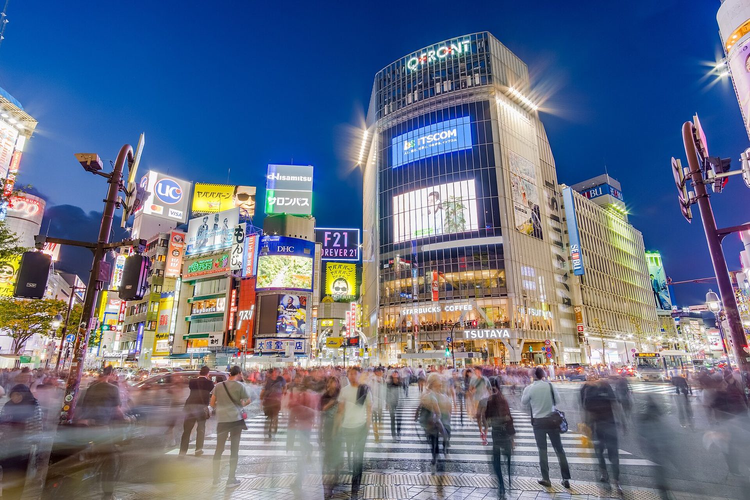
Shibuya Crossing: เมืองโลกรวมผู้คน โครงสร้างพื้นฐาน และเครือข่ายระดับโลกไว้ด้วยกัน
Vocabulary · ⁨คำศัพท์⁩ Train · ⁨ฝึกฝน⁩
English ไทย
World cities/wɜːld ˈsɪtiz/ เมืองระดับโลก
6.4

The Distribution of Cities · ⁨การกระจายตัวของเมือง⁩

Syllabus · ⁨หลักสูตร⁩
English

Enduring Understanding (PSO-6): The presence and growth of cities vary across geographical locations because of physical geography and resources.

Learning Objective PSO-6.C: Identify the different urban concepts such as hierarchy, interdependence, relative size, and spacing that are useful for explaining the distribution, size, and interaction of cities.

  • PSO-6.C.1 Principles that are useful for explaining the distribution and size of cities include rank-size rule, the primate city, gravity, and Christaller’s central place theory.
ไทย

ความเข้าใจที่ยั่งยืน (PSO-6): การมีอยู่และการเติบโตของเมืองมีความแตกต่างกันในแต่ละตำแหน่งทางภูมิศาสตร์เนื่องจากภูมิประเทศและทรัพยากรธรรมชาติ

จุดประสงค์การเรียนรู้ PSO-6.C: ระบุแนวคิดเมืองต่างๆ เช่น ลำดับชั้น, ความพึ่งพาซึ่งกันและกัน, ขนาดสัมพัทธ์, และการจัดวางที่เป็นประโยชน์ต่อการอธิบายการกระจายขนาดและการมีปฏิสัมพันธ์ของเมือง

  • PSO-6.C.1 หลักการที่ใช้ในการอธิบายการกระจายและขนาดของเมือง ได้แก่ กฎอันดับ-ขนาด, เมืองหลัก, แรงโน้มถ่วง, และทฤษฎีสถานที่กลางของ克里斯塔勒。

Source: College Board AP Course and Exam Description · ⁨แหล่งที่มา: คำอธิบายหลักสูตรและข้อสอบ College Board AP⁩

English
The rank-size rule and the primate city
Christaller's central place theory

Cities within a country follow patterns of size and spacing.

  • The rank-size rule 位序规模法则 says the nth-largest city is 1/n the size of the largest (the 2nd city is half the largest, the 3rd a third, and so on).
  • A primate city 首位城市 is far larger than all others (Paris, Bangkok), dominating its country.
  • Central place theory 中心地理论 (Christaller) explains the spacing of settlements: larger centres are fewer and farther apart and offer higher-order goods; their market area is the surrounding region they serve.

Worked example (a real AP exam question). "Compare the concept of a metacity with the concept of a world city." (2024) A full-mark answer: "A metacity is defined by size — a continuous urban area of more than 20 million people — while a world city is defined by influence, acting as a command centre for the global economy. A city such as Tokyo can be both, but a large metacity in a poorer country may not be a world city." The command word Compare needs an explicit point of difference (size versus influence), not two separate definitions sitting side by side.

ไทย

*กฎลำดับขนาดและเมืองหลัก

*ทฤษฎีสถานที่กลางของ Christaller

เมืองภายในประเทศปฏิบัติตามรูปแบบของขนาดและระยะห่าง

  • กฎลำดับขนาด บอกว่าเมืองอันดับ nth มีขนาดเท่ากับ 1/n ของเมืองที่ใหญ่ที่สุด (เมืองที่ 2 มีขนาดครึ่งหนึ่งของเมืองที่ใหญ่ที่สุด เมืองที่ 3 มีขนาดหนึ่งในสาม เป็นต้น)
  • Primate city มีขนาดใหญ่กว่าเมืองอื่นๆ มาก (Paris, Bangkok) และครอบงำประเทศ
  • Central place theory (ของ Christaller) อธิบายการจัดวางตัวของ settlements: ศูนย์กลางขนาดใหญ่มีจำนวนน้อยและห่างกันมากขึ้น sertaเสนอสินค้าระดับสูง; market area ของพวกมันคือภูมิภาคโดยรอบที่ให้บริการ

กฎลำดับขนาดเทียบกับการกระจายตัวของ Primate city *ภายใต้กฎลำดับขนาดเมือง nth จะมีขนาดประมาณ 1/n ของเมืองที่ใหญ่ที่สุด; รูปแบบ Primate มีเมืองหนึ่งเมืองที่ควบคุมและใหญ่กว่าเมืองที่เหลืออย่างชัดเจน

Worked example (a real AP exam question). "เปรียบเทียบแนวคิดของ Metacity กับแนวคิดของ World city." (2024) คำตอบเต็มคะแนน: "Metacity นิยามตามขนาด — พื้นที่เมืองต่อเนื่องที่มีประชากรมากกว่า 20 ล้านคน — ในขณะที่ World city นิยามตามอิทธิพล ทำหน้าที่เป็นศูนย์บัญชาการของเศรษฐกิจโลก เมืองอย่าง Tokyo อาจเป็นทั้งสองอย่างได้ แต่ Metacity ขนาดใหญ่ในประเทศจนอาจไม่ใช่ World city" คำสั่ง Compare ต้องการจุดแตกต่างที่ชัดเจน (ขนาดเทียบกับอิทธิพล) ไม่ใช่คำนิยามแยกกันสองจุดวางข้างกัน

Vocabulary · ⁨คำศัพท์⁩ Train · ⁨ฝึกฝน⁩
English ไทย
primate city/ˈpraɪmeɪt ˈsɪti/ เมืองหลัก
Central place theory/ˈsentrəl pleɪs ˈθɪəri/ ทฤษฎีสถานที่กลาง
6.5

The Internal Structure of Cities · ⁨โครงสร้างภายในของเมือง⁩

Syllabus · ⁨หลักสูตร⁩
English

Enduring Understanding (PSO-6): The presence and growth of cities vary across geographical locations because of physical geography and resources.

Learning Objective PSO-6.D: Explain the internal structure of cities using various models and theories.

  • PSO-6.D.1 Models and theories that are useful for explaining internal structures of cities include the Burgess concentric-zone model, the Hoyt sector model, the Harris and Ullman multiple- nuclei model, the galactic city model, bid-rent theory, and urban models drawn from Latin America, Southeast Asia, and Africa.
ไทย

ความเข้าใจที่ยั่งยืน (PSO-6): การมีอยู่และการเติบโตของเมืองมีความแตกต่างกันในแต่ละตำแหน่งทางภูมิศาสตร์เนื่องจากภูมิประเทศและทรัพยากรธรรมชาติ

จุดประสงค์การเรียนรู้ PSO-6.D: อธิบายโครงสร้างภายในของเมืองโดยใช้โมเดลและทฤษฎีต่างๆ

  • PSO-6.D.1 โมเดลและทฤษฎีที่ใช้ในการอธิบายโครงสร้างภายในของเมือง ได้แก่ โมเดลโซนแบบวงกลมของ伯吉斯, โมเดล sektor ของ霍伊特, โมเดลหลายแกนของ哈里斯和厄尔曼, โมเดลเมืองกาแล็กซี, ทฤษฎีค่าเช่า_bid, และโมเดลเมืองที่มาจากอเมริกาใต้, เอเชียตะวันออกเฉียงใต้ และแอฟริกา

Source: College Board AP Course and Exam Description · ⁨แหล่งที่มา: คำอธิบายหลักสูตรและข้อสอบ College Board AP⁩

English
Models of the internal city

Three classic models describe how North American cities are arranged inside.

  • Concentric zone model 同心圆模型 (Burgess) — rings around the Central Business District (CBD) 中央商务区, from inner-city to commuter suburbs.
  • Sector model 扇形模型 (Hoyt) — land use grows outward in wedges along transport routes.
  • Multiple nuclei model 多核心模型 (Harris–Ullman) — the city has several centres (nodes), not just one CBD, as it grows and specialises.

Developing-world cities have their own models (e.g. the Latin American, or Griffin–Ford, model with a spine of wealth from the centre).

ไทย
โมเดลของเมืองภายใน

โมเดลคลาสสิกสามแบบอธิบาย how North American cities are arranged inside

สาม urban models: concentric zone, sector, และ multiple nuclei
โมเดล concentric-zone, sector, และ multiple-nuclei อธิบาย city land use ต่างกัน
  • โมเดล zonе круговой (Concentric zone model) – Burgess — rings around Central Business District (CBD), จาก inner-city ไปยัง commuter suburbs
  • โมเดล Sector (Sector model) – Hoyt — land use grows outward เป็น wedges ตาม transport routes
  • โมเดลหลายศูนย์กลาง (Harris–Ullman) — เมืองมีศูนย์กลางหลายแห่ง (โหนด) ไม่ใช่เพียงจุดเดียวอย่างเขตธุรกิจกลางเมือง (CBD) เมื่อเมืองขยายตัวและมีความเชี่ยวชาญเฉพาะด้าน

เมืองในประเทศกำลังพัฒนา มีโมเดลของตนเอง (เช่น โมเดลอเมริกา Latina หรือ Griffin–Ford ที่มีแกนความมั่งคั่งแผ่ขยายจากศูนย์กลาง)

Explore · ⁨สำรวจ⁩

Which urban model is it? · ⁨นี่คือแบบจำลองเมืองรูปแบบใด?⁩

The concentric zone model uses rings around the CBD; the sector model uses wedges along transport routes; the multiple nuclei model has several centres. · ⁨แบบจำลอง ⟦concentric zone⟧ ใช้วงกลมรอบพื้นที่ธุรกิจกลางเมือง (CBD); แบบจำลอง ⟦sector⟧ ใช้รูปทรงสามเหลี่ยมตามเส้นทางขนส่ง; และแบบจำลอง ⟦multiple nuclei⟧ มีศูนย์กลางหลายแห่ง⁩

Vocabulary · ⁨คำศัพท์⁩ Train · ⁨ฝึกฝน⁩
English ไทย
Concentric zone model/kənˈsentrɪk zəʊn ˈmɒdl/ โมเดลโซนวงกลมซ้อนกัน
Central Business District (CBD)/ˈsentrəl ˈbɪznəs ˈdɪstrɪkt/ เขตธุรกิจกลาง (CBD)
Sector model/ˈsektə ˈmɒdl/ โมเดลภาคส่วน
Multiple nuclei model/ˈmʌltɪpl ˈnjuːklɪi ˈmɒdl/ โมเดลแกนกลางหลายแห่ง
Zoning/ˈzəʊnɪŋ/ Zoning
Infrastructure/ˈɪnfrəstrʌktʃə/ زیرโครงสร้าง
informal settlements/ɪnˈfɔːml ˈsetəlmənts/ พื้นที่อยู่อาศัยไม่ทางการ
Smart-growth/smɑːt ɡrəʊθ/ การพัฒนาอัจฉริยะ
Greenbelts/ˈɡriːnbelts/ เขตรับรองสีเขียว
urban renewal/ˈɜːbən rɪˈnjuːəl/ urban renewal
6.6 6.7

Density, Land Use, and Infrastructure · ⁨ความหนาแน่น การใช้ที่ดิน และโครงสร้างพื้นฐาน⁩

Syllabus · ⁨หลักสูตร⁩
English

Enduring Understanding (IMP-6): The attitudes and values of a population, as well as the balance of power within that population, are reflected in the built landscape.

Learning Objective IMP-6.A: Explain how low-, medium-, and high-density housing characteristics represent different patterns of residential land use.

  • IMP-6.A.1 Residential buildings and patterns of land use reflect and shape the city’s culture, technological capabilities, cycles of development, and infilling.
ไทย

ความเข้าใจที่ยั่งยืน (IMP-6): ทัศนคติและค่านิยมของประชากร รวมถึงสมดุลของอำนาจภายในประชากรนั้น สะท้อนออกมาในภูมิทัศน์ที่สร้างขึ้น

จุดประสงค์การเรียนรู้ IMP-6.A: อธิบายว่าลักษณะที่อยู่อาศัยความหนาแน่นต่ำ กลาง และสูง แสดงถึงรูปแบบการใช้ที่ดินเพื่ออยู่อาศัยที่แตกต่างกันอย่างไร

  • IMP-6.A.1 อาคารที่พักอาศัยและรูปแบบการใช้ดินสะท้อนและกำหนดวัฒนธรรมความสามารถทางเทคโนโลยีรอบการพัฒนา และการเติมเต็มของเมือง
English

Enduring Understanding (IMP-6): The attitudes and values of a population, as well as the balance of power within that population, are reflected in the built landscape.

Learning Objective IMP-6.B: Explain how a city’s infrastructure relates to local politics, society, and the environment.

  • IMP-6.B.1 The location and quality of a city’s infrastructure directly affects its spatial patterns of economic and social development.
ไทย

ความเข้าใจที่ยั่งยืน (IMP-6): ทัศนคติและค่านิยมของประชากร รวมถึงสมดุลของอำนาจภายในประชากรนั้น สะท้อนออกมาในภูมิทัศน์ที่สร้างขึ้น

จุดประสงค์การเรียนรู้ IMP-6.B: อธิบายว่าโครงสร้างพื้นฐานของเมืองมีความเกี่ยวข้องกับ politics, society, and environment的地方如何关联。

  • IMP-6.B.1 ตำแหน่งและคุณภาพของโครงสร้างพื้นฐานของเมืองส่งผลโดยตรงต่อรูปแบบเชิงพื้นที่ของการพัฒนาทางเศรษฐกิจและสังคม

Source: College Board AP Course and Exam Description · ⁨แหล่งที่มา: คำอธิบายหลักสูตรและข้อสอบ College Board AP⁩

English
Bid-rent theory

Inside the city, land use and density change from centre to edge.

  • Density is highest near the CBD (tall buildings, high land prices) and falls outward — the bid-rent curve again.
  • Zoning 分区规划 laws separate land uses (residential, commercial, industrial).
  • Infrastructure 基础设施 — roads, water, power, transit — must grow with the city; where it lags, informal settlements 非正规住区 (slums) may form.
ไทย
ทฤษฎีค่าเช่าสูงสุด

ภายในเมือง การใช้ที่ดินและความหนาแน่นจะเปลี่ยนแปลงจากศูนย์กลางไปยังขอบเขต

  • ความหนาแน่น สูงสุดใกล้กับ CBD (อาคารสูง, ราคาที่ดินแพง) และลดลงเมื่อออกไปข้างนอก — ซึ่งสอดคล้องกับเส้นโค้งของ ค่าเช่าสูงสุด อีกครั้ง
  • กฎหมาย zonning แยกการใช้ที่ดิน (ที่อยู่อาศัย, พาณิชย์, อุตสาหกรรม)
  • โครงสร้างพื้นฐาน — ถนน น้ำ ไฟฟ้า การขนส่ง — ต้องเติบโตไปกับเมือง; หากขาดแคลน จะ可能导致การเกิด ชุมชนไม่เป็นทางการ (สลัม)
บ้านสร้างเองที่แน่นหนาปกคลุมเนินเขาชันเหนือผิวน้ำในริโอเดจาเนโร
ชุมชนไม่เป็นทางการ (ฟาวেলা) บนเนินเขาในริโอเดจาเนโร สร้างขึ้นในพื้นที่ที่ที่อยู่อาศัยและบริการตามไม่ทันการเติบโตทางเมืองอย่างรวดเร็ว
6.8 6.9

Urban Sustainability and Data · ⁨ความยั่งยืนของเมืองและข้อมูล⁩

Syllabus · ⁨หลักสูตร⁩
English

Enduring Understanding (IMP-6): The attitudes and values of a population, as well as the balance of power within that population, are reflected in the built landscape.

Learning Objective IMP-6.C: Identify the different urban design initiatives and practices.

  • IMP-6.C.1 Sustainable design initiatives and zoning practices include mixed land use, walkability, transportation-oriented development, and smart-growth policies, including New Urbanism, greenbelts, and slow-growth cities.

Learning Objective IMP-6.D: Explain the effects of different urban design initiatives and practices.

  • IMP-6.D.1  Praise for urban design initiatives includes the reduction of sprawl, improved walkability and transportation, improved and diverse housing options, improved livability and promotion of sustainable options. Criticisms include increased housing costs, possible de facto segregation, and the potential loss of historical or place character.
ไทย

ความเข้าใจที่ยั่งยืน (IMP-6): ทัศนคติและค่านิยมของประชากร รวมถึงสมดุลของอำนาจภายในประชากรนั้น สะท้อนออกมาในภูมิทัศน์ที่สร้างขึ้น

จุดประสงค์การเรียนรู้ IMP-6.C: ระบุโครงการออกแบบเมืองและแนวปฏิบัติต่างๆ

  • IMP-6.C.1 โครงการออกแบบที่ยั่งยืนและแนวปฏิบัติ zonning รวมถึงการใช้ที่ดินแบบผสม, ความสามารถในการเดินเท้า, การพัฒนาที่เน้นการขนส่ง, และนโยบาย smart-growth รวมถึง New Urbanism, เขียว belt, และเมือง slow-growth

จุดประสงค์การเรียนรู้ IMP-6.D: อธิบายผลกระทบของโครงการออกแบบเมืองและแนวปฏิบัติต่างๆ

  • IMP-6.D.1 การชื่นชมโครงการออกแบบเมืองรวมถึงการลดการขยายตัว, การเพิ่มความสามารถในการเดินเท้าและการขนส่ง, ตัวเลือกที่อยู่อาศัยที่ดีขึ้นและหลากหลายขึ้น, การเพิ่มความเป็นอยู่ที่ดีและการส่งเสริมตัวเลือกที่ยั่งยืน ข้อวิจารณ์รวมถึงต้นทุนที่อยู่อาศัยที่เพิ่มขึ้น, การแบ่งแยกโดยนัยที่เป็นไปได้, และการสูญเสียลักษณะทางประวัติศาสตร์หรือลักษณะเฉพาะของสถานที่
English

Enduring Understanding (IMP-6): The attitudes and values of a population, as well as the balance of power within that population, are reflected in the built landscape.

Learning Objective IMP-6.E: Explain how qualitative and quantitative data are used to show the causes and effects of geographic change within urban areas.

  • IMP-6.E.1 Quantitative data from census and survey data provide information about changes in population composition and size in urban areas.
  • IMP-6.E.2 Qualitative data from field studies and narratives provide information about individual attitudes toward urban change.
ไทย

ความเข้าใจที่ยั่งยืน (IMP-6): ทัศนคติและค่านิยมของประชากร รวมถึงสมดุลของอำนาจภายในประชากรนั้น สะท้อนออกมาในภูมิทัศน์ที่สร้างขึ้น

จุดประสงค์การเรียนรู้ IMP-6.E: อธิบายว่าข้อมูลเชิงคุณภาพและเชิงปริมาณถูกใช้ในการแสดงสาเหตุและผลกระทบของการเปลี่ยนแปลงทางภูมิศาสตร์ภายในพื้นที่เมืองอย่างไร

  • IMP-6.E.1 ข้อมูลเชิงปริมาณจากสำมะโนประชากรและข้อมูลการสำรวจให้ข้อมูลเกี่ยวกับการเปลี่ยนแปลงองค์ประกอบและขนาดประชากรในพื้นที่เมือง
  • IMP-6.E.2 ข้อมูลเชิงคุณภาพจากการศึกษาภาคสนามและเรื่องราวให้ข้อมูลเกี่ยวกับทัศนคติส่วนบุคคลต่อการเปลี่ยนแปลงในเมือง

Source: College Board AP Course and Exam Description · ⁨แหล่งที่มา: คำอธิบายหลักสูตรและข้อสอบ College Board AP⁩

English

Planners use data and design to make cities work better.

  • Smart-growth 精明增长, mixed-use development, and transit-oriented design fight sprawl and car dependence.
  • Greenbelts 绿带 limit outward growth; urban renewal 城市更新 rebuilds decayed areas, but can cause gentrification 中产阶级化 that displaces poorer residents.
  • Census and geospatial data guide where to put schools, transit, and services.
ไทย

นักวางแผนใช้ ข้อมูล และการออกแบบเพื่อให้เมืองทำงานได้ดีขึ้น

  • การพัฒนาแบบ เติบโตอัจฉริยะ, การใช้ประโยชน์ที่ดินผสมผสาน, และการออกแบบที่เน้น การขนส่งสาธารณะ ช่วยต่อต้านการขยายตัวของเมืองและการพึ่งพารถยนต์
  • เขียวกobelts จำกัดการขยายตัวออกไป; การพัฒนาใหม่ในเมือง สร้างพื้นที่เสื่อมโทรมขึ้นใหม่ แต่อาจทำให้เกิด การเปลี่ยนผ่านทางสังคม ที่ผลัก居民ยากจนออกจากพื้นที่
  • ข้อมูล จากสำมะโนประชากรและภูมิศาสตร์นำทางในการกำหนดตำแหน่งโรงเรียน การขนส่ง และบริการต่างๆ
6.10 6.11

Challenges of Urban Changes and Sustainability · ⁨ปัญหาของการเปลี่ยนแปลงทางเมืองและความยั่งยืน⁩

Syllabus · ⁨หลักสูตร⁩
English

Enduring Understanding (SPS-6): Urban areas face unique economic, political, cultural, and environmental challenges.

Learning Objective SPS-6.A: Explain causes and effects of geographic change within urban areas.

  • SPS-6.A.1 As urban populations move within a city, economic and social challenges result, including: issues related to housing and housing discrimination such as redlining, blockbusting, and affordability; access to services; rising crime; environmental injustice; and the growth of disamenity zones or zones of abandonment.
  • SPS-6.A.2 Squatter settlements and conflicts over land tenure within large cities have increased.
  • SPS-6.A.3 Responses to economic and social challenges in urban areas can include inclusionary zoning and local food movements.
  • SPS-6.A.4 Urban renewal and gentrification have both positive and negative consequences.
  • SPS-6.A.5 Functional and geographic fragmentation of governments—the way government agencies and institutions are dispersed between state, county, city, and neighborhood levels—presents challenges in addressing urban issues.
ไทย

ความเข้าใจที่ยั่งยืน (SPS-6): พื้นที่เมืองเผชิญกับความท้าทายด้านเศรษฐกิจ, การเมือง, วัฒนธรรม และสิ่งแวดล้อมที่เป็นเอกลักษณ์

จุดประสงค์การเรียนรู้ SPS-6.A: อธิบายสาเหตุและผลกระทบของการเปลี่ยนแปลงทางภูมิศาสตร์ภายในพื้นที่เมือง

  • SPS-6.A.1 เมื่อประชากรในเมืองเคลื่อนย้ายภายในเมือง จะเกิดปัญหาทางเศรษฐกิจและสังคม เช่น: ปัญหาเกี่ยวกับที่อยู่อาศัยและการเลือกปฏิบัติต่อผู้เช่าเช่น การแบ่งเขตสี (redlining), การสลับกลุ่มบ้าน (blockbusting), และความคุ้มค่าในการเข้าถึง; การเข้าถึงบริการ; อัตราอาชญากรรมที่เพิ่มขึ้น; ความไม่เท่าเทียมด้านสิ่งแวดล้อม; และการขยายตัวของเขตที่มีสิ่งรบกวนหรือเขตที่ถูกทิ้งร้าง
  • SPS-6.A.2 ชุมชนคนไร้ที่พำนักและความขัดแย้งเรื่องสิทธิ์ในที่ดินในเมืองใหญ่ได้เพิ่มขึ้น
  • SPS-6.A.3 การตอบโต้ต่อความท้าทายทางเศรษฐกิจและสังคมในพื้นที่เมืองอาจรวมถึงการกำหนด zonning แบบรวม社会力量 (inclusionary zoning) และการเคลื่อนไหวเพื่ออาหารท้องถิ่น
  • SPS-6.A.4 การปรับปรุงเมืองและการเปลี่ยนแปลงสภาพแวดล้อมมีทั้งผลดีและผลเสีย
  • SPS-6.A.5 การแบ่งแยกหน้าที่และเชิงพื้นที่ของหน่วยงานราชการ—即以政府机构和机构的分散在州、县、市和社区层面—提出了应对城市问题的挑战。
English

Enduring Understanding (SPS-6): Urban areas face unique economic, political, cultural, and environmental challenges.

Learning Objective SPS-6.B: Describe the effectiveness of different attempts to address urban sustainability challenges.

  • SPS-6.B.1 Challenges to urban sustainability include suburban sprawl, sanitation, climate change, air and water quality, the large ecological footprint of cities, and energy use.
  • SPS-6.B.2 Responses to urban sustainability challenges can include regional planning efforts, remediation and redevelopment of brownfields, establishment of urban growth boundaries, and farmland protection policies.
ไทย

ความเข้าใจที่ยั่งยืน (SPS-6): พื้นที่เมืองเผชิญกับความท้าทายด้านเศรษฐกิจ, การเมือง, วัฒนธรรม และสิ่งแวดล้อมที่เป็นเอกลักษณ์

จุดประสงค์การเรียนรู้ SPS-6.B: อธิบายประสิทธิภาพของแนวทางต่างๆ ในการแก้ปัญหาความยั่งยืนในเมือง

  • SPS-6.B.1 ความท้าทายด้านความยั่งยืนในเมือง รวมถึงการขยายตัวของปริมณฑล, ระบบสุขาภิบาล, การเปลี่ยนแปลงสภาพภูมิอากาศ, คุณภาพอากาศและน้ำ, รอยเท้าทางนิเวศวิทยาขนาดใหญ่ของเมือง, และการใช้พลังงาน
  • SPS-6.B.2 การตอบโต้ต่อความท้าทายด้านความยั่งยืนในเมืองอาจรวมถึงความพยายามวางแผนระดับภูมิภาค, การฟื้นฟูและพัฒนาพื้นที่สีน้ำตาล (brownfields), การกำหนดขอบเขตการเติบโตของเมือง, และนโยบายคุ้มครองพื้นที่เกษตรกรรม

Source: College Board AP Course and Exam Description · ⁨แหล่งที่มา: คำอธิบายหลักสูตรและข้อสอบ College Board AP⁩

English

Rapid urban growth brings problems:

  • Social: housing shortages, segregation, and the displacement caused by gentrification.
  • Environmental: air and water pollution, the urban heat island 城市热岛 effect, waste, and heavy resource use.
  • Economic: strained budgets, congestion, and the cost of extending infrastructure to sprawling edges.

Sustainable cities try to grow up rather than out, invest in public transit, and mix homes with jobs and services.

ไทย

การเติบโตทางเมืองอย่างรวดเร็วนำมาซึ่งปัญหา:

  • ด้านสังคม: ขาดแคลนที่อยู่อาศัย, การแยกกลุ่มทางสังคม, และการถูก displaced โดยกระบวนการ gentrification
  • ด้านสิ่งแวดล้อม: มลพิษทางอากาศและน้ำ,ปรากฏการณ์ เกาะความร้อนในเมือง, ขยะ, และการใช้ทรัพยากรจำนวนมาก
  • ด้านเศรษฐกิจ: งบประมาณตึงเครียด, การจราจรติดขัด, และค่าใช้จ่ายในการขยายโครงสร้างพื้นฐานไปยังขอบเขตที่กระจายตัว

เมืองที่ยั่งยืนพยายามพัฒนา ขึ้น แทนที่จะ ขยายออก, ลงทุนในระบบขนส่งสาธารณะ และผสมผสานที่พักอาศัย เข้ากับสถานที่ทำงานและบริการ

Vocabulary · ⁨คำศัพท์⁩ Train · ⁨ฝึกฝน⁩
English ไทย
gentrification/ˌdʒentrɪfɪˈkeɪʃn/ gentrification
urban heat island/ˈɜːbən hiːt ˈaɪlənd/ เกาะความร้อนในเมือง (urban heat island)
6.10 6.11

Exam tips · ⁨ข้อแนะนำสำหรับการสอบ⁩

English
  • Separate a city's site (physical setting) from its situation (position relative to others).
  • Apply the rank-size rule (the nth city is about 1/n of the largest) and spot a primate city.
  • Match a city description to the right model: concentric zone, sector, or multiple nuclei.
  • Link land value to density — costly central land is used by building upward.
  • Discuss change with suburbanization, sprawl, and gentrification, and smart-growth responses.
ไทย
  • แยกแยะระหว่าง ที่ตั้งทางกายภาพ (physical setting) กับ ตำแหน่งสัมพัทธ์ (situation) ของเมือง
  • ใช้ กฎลำดับขนาด (rank-size rule) ซึ่งเมืองที่ ⟦n⟧ มีขนาดประมาณ 1/n ของเมืองที่ใหญ่ที่สุด และระบุ เมืองหลัก (primate city)
  • จับคู่คำอธิบายเมืองเข้ากับแบบจำลองที่เหมาะสม: เขตวงกลมซ้อน, โซนรูปพัด, หรือ แก่นกลางหลายแห่ง
  • เชื่อมโยง มูลค่าที่ดิน กับความหนาแน่น — ที่ดินศูนย์กลางที่มีราคาสูงมักถูกใช้โดยการสร้างตึกสูงขึ้น
  • อภิปรายถึงการเปลี่ยนแปลงจาก การขยายตัวชานเมือง, การกระจายตัวของเมือง, และ การปรับปรุงสภาพพื้นที่, พร้อมกับการตอบสนองด้วย การพัฒนาอย่างชาญฉลาด
Vocabulary · ⁨คำศัพท์⁩ Train · ⁨ฝึกฝน⁩
English ไทย
rank-size rule/ræŋk saɪz ruːl/ กฎขนาด-อันดับ

Interactive lessons on this topic · ⁨บทเรียนเชิงโต้ตอบสำหรับหัวข้อนี้⁩

Work through it step by step, with instant-check exercises. · ⁨ทำทีละขั้นตอน พร้อมแบบฝึกหัดตรวจสอบผลทันที⁩

Past Papers · ⁨ข้อสอบย้อนหลัง⁩

More topics in AP Human Geography · ⁨AP ภูมิศาสตร์มนุษย์⁩ · ⁨หัวข้อเพิ่มเติมใน AP Human Geography · ⁨AP ภูมิศาสตร์มนุษย์⁩⁩

Log in or create account · ⁨เข้าสู่ระบบหรือสร้างบัญชี⁩

IGCSE, A-Level & AP