Geographic Data
Introduced| English | Meaning |
|---|---|
| Geographic data/ˌdʒɪəˈɡræfɪk ˈdeɪtə/ | Information describing locations, spatial features or characteristics associated with places. |
| GIS/ˌdʒiː aɪ ˈes/ | Computer-based systems for storing, combining, analysing and displaying geographically referenced data. |
| Remote sensing/rɪˈməʊt ˈsensɪŋ/ | Collecting information about Earth's surface from a distance, commonly with sensors on aircraft or satellites. |
Data tied to a place
- Geographic data 地理数据 is any information linked to a location.
- Geographers collect it in the field (counting, surveying, interviewing) and remotely with technology.
- Good data is the raw material of every map and every decision.
Geospatial technologies
- GIS 地理信息系统 layers many kinds of spatial data so patterns can be compared.
- GPS pinpoints an exact location on Earth using satellites.
- Remote sensing 遥感 gathers data from satellites or aircraft without touching the ground.
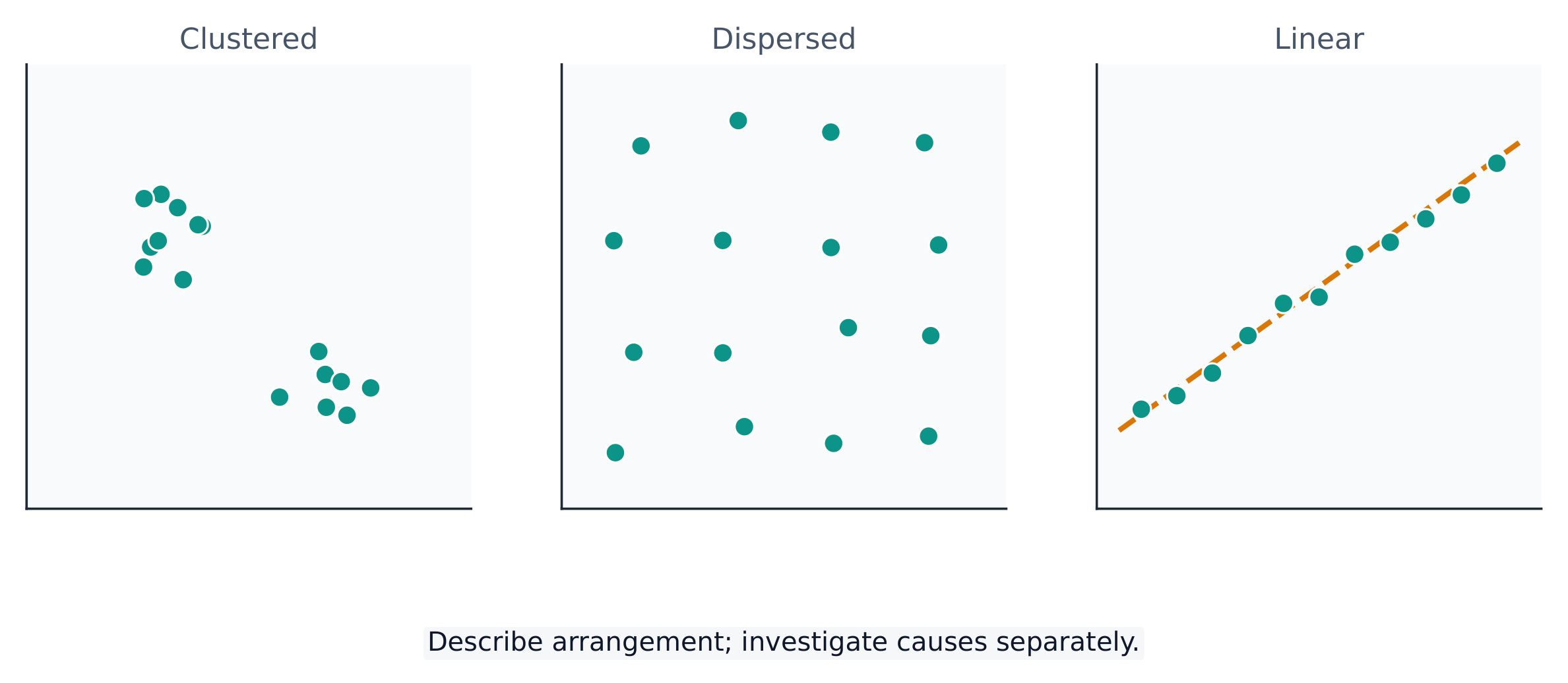
Describe a spatial pattern: clustered, dispersed or linear
Field or geospatial technology?
Sort each data source as collected in the field or by a geospatial technology.
The technology that layers many kinds of spatial data to compare patterns is...
Difficulty 1/5 · 100 coins + a small bonus on first completion today
GIS (Geographic Information System) layers spatial data so relationships appear.
GPS is used mainly to find an exact location on Earth.
Difficulty 1/5 · 100 coins + a small bonus on first completion today
GPS uses satellites to pinpoint location; GIS is for analysis and remote sensing is for data capture.
Gathering data from satellites or aircraft without touching the ground is called remote ____.
Difficulty 1/5 · 100 coins + a small bonus on first completion today
Remote sensing captures data from above — satellite and aerial imagery.
Select all geospatial technologies.
Difficulty 2/5 · 140 coins + a small bonus on first completion today
GIS, GPS, and remote sensing are geospatial technologies; a paper diary is not.
Match each technology to its main job.
Difficulty 2/5 · 140 coins + a small bonus on first completion today
GIS analyses, GPS locates, remote sensing captures imagery from above.
Data from words and pictures
- Not all data is numbers: field notes, media reports, and travel writing all count.
- Interviews, policy documents, and photographs give qualitative information.
- Mixing many sources gives a fuller picture of a place.
Data is never complete or perfectly neutral. Who collected it, which categories they used, and which places they sampled all shape what the data seems to say. Always ask where the data came from.
Why GIS is powerful
- GIS stores each kind of data as a layer — roads, rivers, income, flood risk.
- Turning layers on and off reveals relationships you could not see alone.
- This is why GIS is the geographer's most important modern tool.
A city planner opens a GIS map and switches on two layers: a flood-risk layer and a housing layer. Where the layers overlap, they can see exactly which homes are at risk — and plan defences.
Geographic data links information to a place. It is collected in the field and by geospatial technologies — GIS (layered analysis), GPS (location), and remote sensing (data from above). All data is selective, so always question the source.
Write from a satellite image as remote sensing
- A satellite records crop health across a valley.
- Nobody walked the fields to collect those readings.
What kind of geographic data collection is this?
Remote sensing gathers information without touching the place.
What collected the crop-health image?
Difficulty 1/5 · 100 coins + a small bonus on first completion today
The satellite sensed the fields from orbit.